Back to previous page

Indonesia: Digital transformation for food security

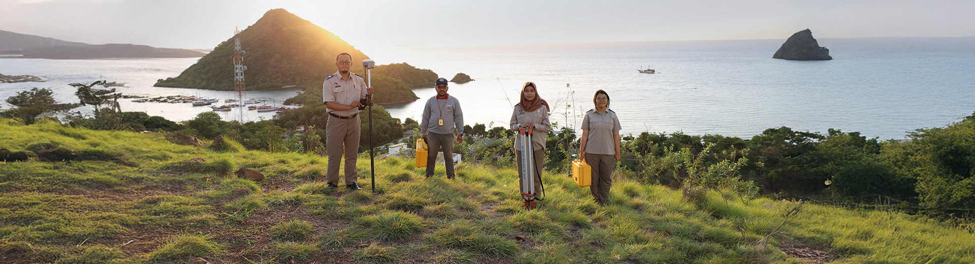
This project aims to develop a geo-information and satellite imagery eco-system in Indonesia. Working together with Indonesian counterparts, this project facilitates Dutch and Indonesian companies in the geo-spatial, agri-food, water and climate sector. At the same time, it will improve public governance systems in Indonesia.

This new ecosystem will support the Indonesian OneData and OneMap policies. It is inspired by the Dutch Public Services on the Map (PDOK) platform.

We want to show that a strong geo-spatial data eco-system in Indonesia will provide direct benefits for farmers and policy makers on a local level.

Luc Groot  - International Portfolio Manager

More about this project

  1. Establishing a Proof of Concept for a collaborative digital ecosystem that combines spatial, financial and legal data. This will enable sustainable agricultural practices, better land management and informed governance. 
  2. Improving business and policy environment leading to more investments in the agriculture, water, climate, earth observation and geo-information sectors in Indonesia.
  3. Providing input for strengthening and operationalising the planned investment in public infrastructure by different parties. Such as Invest International, the World Bank ILASP program, and other aid and trade development tools by international financiers.
  1. A refined and clearly defined Proof of Concept.
  2. The Dutch-Indonesian Geo-info and Satellite Imagery council for Food in Indonesia (GiSiFIn) has been initiated.
  3. A practical business case for an improved Indonesian National Spatial Data Infrastructure (NSDI) Framework.

2025-2026

  • Ministry of Agriculture (Kementan)
  • Coordinating Ministry for Food Affairs (Kemenko Pangan)
  • National Planning Agency (Bappenas)
  • Ministry of Agrarian Affairs and Spatial Planning/National Land Agency (ATR/BPN)
  • Indonesian Geospatial Information Agency (BIG)  
  • Gadjah Mada University

News

Nieuws item: See it, report it! Feedback tool for Rwanda’s citizens

Scaling up our monitoring and ensuring compliance in Rwanda, we’re creating a feedback tool for citizens.

Read more

Other projects

Bosnia-Herzegovina: GeoConnect and geospatial expertise

Project GeoConnect aims to expand the use of geospatial and remotely sensed data in Bosnia-Herzegovina. It focuses on integrating this data into the country’s national spatial data infrastructures (NSDIs).

Moldova: Supporting National Spatial Data Infrastructure

This project improved Moldova’s ability to use geospatial data to address key societal and environmental challenges.

Chad: towards inclusive land governance

This project focuses on securing land rights in Chad. It aims to advance Chad’s land reform, improve food security, social cohesion, and economic development.